
Overview
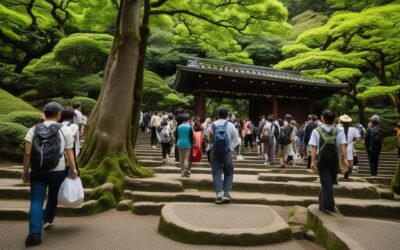
💬 Traveler’s Note: I visited Mount Oyama on a clear late-autumn morning and explored the stone staircase through the cedar forest before the crowds arrived. I recommend taking the first cable car up — the summit views over Sagami Bay are worth the early start, and the trail is far quieter before 9 AM.
Overview of Tanzawa-Oyama
| Detail | Information |
|---|---|
| Location | Western Kanagawa Prefecture |
| Area | 27,000+ hectares of protected forest |
| Peak | Mount Hiru (1,673m) |
| Season | April–November (main season), December–March (winter gear required) |
| Getting there | 90 minutes from Shinjuku by Odakyu Line |
| Difficulty range | Easy (family walks) to Challenging (full-day summit hikes) |
Getting to Tanzawa-Oyama
By Train (Recommended)
| Route | Duration | Cost (One Way) | Notes |
|---|---|---|---|
| Shinjuku → Odakyu Line → Shibusawa Station | 90 min | ¥1,100 | Most common access, bus to trailheads |
| Shinjuku → Odakyu Line → Hon-Atsugi Station | 65 min | ¥830 | Access to Mount Oyama |
| Shinjuku → Odakyu Romancecar → Hon-Atsugi | 50 min | ¥1,320 | Reserved seat, comfortable |
By Car
From Tokyo, take the Tomei Expressway to Atsugi IC (50 minutes), then follow Route 246 toward Tanzawa, Parking available at most trailheads (¥500-1,000/day).
Best Hiking Trails
1. Mount Oyama (Beginner-Friendly)
Mount Oyama (1,252m) is the most popular hiking destination in Tanzawa and the easiest summit to reach. The mountain has been a sacred site for centuries and is dotted with Shinto shrines.
| Detail | Information |
|---|---|
| Duration | 3-4 hours round trip |
| Distance | 5.5 km round trip |
| Elevation gain | 600m |
| Difficulty | Easy to Moderate |
| Best season | April–November |
Route:
- From Hon-Atsugi Station, take the bus to Oyama Cable Car Station (30 min, ¥700)
- Ride the Oyama Cable Car to the top station (7 min, ¥700 one way)
- Hike from the cable car top to the summit (45 min-1 hour)
- Visit Oyama Afuri Shrine (main shrine, waterfall, views)
- Descend via the same route or the longer womenmonomichi trail
Highlights: Oyama Afuri Shrine, panoramic views of Sagami Bay, Mount Fuji on clear days Discover Mt Fuji’s 5th Station, World Heritage Center & Owakudani on this Hakone day trip
2. Lake Tanzawa Loop (Easy, FLakey-Friendly)
A flat, well-maintained walking path around Lake Tanzawa (Miyagase Lake) — perfect for families and casual walkers.
| Detail | Information |
|---|---|
| Duration | 1.5-2 hours |
| Distance | 5 km loop |
| Elevation gain | Minimal (flat) |
| Difficulty | Easy |
| Best season | Year-round |
Route: From Shibusawa Station, take the bus to Lake Tanzawa (25 min, ¥500). Follow the paved path around the lake, stopping at rest areas, picnic spots, and the Miyagase Dam. Highlights: Lake views, Miyagase Dam, picnic areas, restrooms at multiple points
3. Mount Hiru Summit (Challenging, Full Day)
Mount Hiru (1,673m) is the highest peak in the Tanzawa range and the most rewarding hike for experienced hikers.
| Detail | Information |
|---|---|
| Duration | 6-8 hours round trip |
| Distance | 12 km round trip |
| Elevation gain | 900m |
| Difficulty | Challenging |
| Best season | May–October |
Route:
- From Shibusawa Station, bus to the trailhead at Yabitsu Pass (40 min, ¥800)
- Hike from Yabitsu Pass to Mount Hiru summit (3-4 hours)
- Summit break (30 min-1 hour)
- Return via the same route or the Nabewari Pass loop
Warning: This is a serious mountain hike, Bring proper hiking boots, at least 2 liters of water, food, rain gear, and warm layers even in summer. The temperature at the summit can be 10°C cooler than at the trailhead.
4. Mizugasenba Plateau (Moderate, Scenic)
A beautiful highland plateau with rolling hills and panoramic views — perfect for photographers and nature lovers.
| Detail | Information |
|---|---|
| Duration | 3-4 hours round trip |
| Distance | 6 km |
| Elevation gain | 350m |
| Difficulty | Moderate |
| Best season | June–October (flowers), October–November (autumn colors) |
Route: From Shibusawa Station, bus to Tanzawa-ko (Lake Tanzawa) and follow the signs toward Mizugasenba. The trail climbs through forest before opening onto a massive plateau with 360-degree views. Highlights: Wildflowers in summer, autumn foliage, mountain views
Trail Comparison
| Trail | Duration | Difficulty | Best For | Crowds |
|---|---|---|---|---|
| Mount Oyama | 3-4 hours | Easy-Moderate | Beginners, families, shrine visits | Medium |
| Lake Tanzawa Loop | 1.5-2 hours | Easy | Families, photo walks, picnics | Low |
| Mount Hiru | 6-8 hours | Challenging | Experienced hikers, summit seekers | Low |
| Mizugasenba Plateau | 3-4 hours | Moderate | Photographers, nature lovers | Low |
Getting to the Trailheads
All trailheads are accessible by public transport from Shinjuku Station via the Odakyu Line. For Mount Oyama, take the Odakyu Romancecar to Hon-Atsugi Station (50 min, ¥1,320 reserved seat), then bus to Oyama Cable Car Station (30 min, ¥700). For Lake Tanzawa and Mizugasenba, take the Odakyu Line to Shibusawa Station (90 min, ¥1,100), then bus to the trailheads (25-40 min, ¥500-800). Buses run approximately once per hour — always check the return schedule before setting out, as the last bus departs as early as 4:30 PM on some routes.
Where to Eat
There are limited food options within the park itself. The Mount Oyama cable car top station has a restaurant serving soba noodles and set meals (¥800-1,200). Lake Tanzawa has a small shop selling snacks and drinks. For all other trails, you must bring your own food and water. After hiking, Hon-Atsugi Station has numerous restaurants and izakayas — try the local Atsugi-style ramen (¥800-1,000) for a rewarding post-hike meal.
Safety Tips for Beginners
- Always register your hike at the trailhead box (登山計画書) — it’s mandatory and helps rescue services if you don’t return
- Download offline maps before heading out — cell reception is unreliable in mountain valleys
- Check the mountain-specific weather forecast (Tanzawa-sanchi) rather than Tokyo’s forecast
- Start early (by 8 AM) to ensure you catch the last return bus
- Carry a whistle and headlamp even for short hikes — trails take longer than expected
- Tell someone your planned route and expected return time
Getting There
The activity locations in this guide are accessible by public transport. Major train stations have clear signage in English. For remote locations, consider renting a bicycle from the station area. Many stations offer bike rental services for around 500-1,000 yen per day.
What to Expect
Most activities are designed to be accessible for international visitors. Staff at popular attractions are accustomed to non-Japanese speakers and can communicate through basic English or translation apps. Duration varies from 1-2 hour experiences to half-day adventures. Wear appropriate clothing – many activities involve walking or standing for extended periods. Some outdoor activities may have age or height restrictions. Always check the official website before visiting for the latest information.
Nearby Recommendations
Combine your activity with nearby attractions for a full-day experience. Many activity locations are close to other points of interest, making it easy to plan a varied itinerary. Check the official website for nearby partner attractions that offer discounts when visited together. Most areas have good lunch options within walking distance of activity venues.
Local Tips
Regular participants recommend bringing your own water bottle and wearing moisture-wicking clothing for active experiences. Arriving 15 minutes before your scheduled time allows for check-in and preparation. Many activities have seasonal variations, so check what’s available during your visit. Don’t be shy about asking questions – instructors are happy to help.n
Conclusion
Whether you are planning exploring Kanagawa for its hike for the first time or returning for another visit, taking a little extra time to go beyond the obvious sights makes all the difference. During my visit I went with a rough plan and found that leaving room to wander made the trip far more memorable. I hope this guide helps you build an itinerary that fits your pace, and that your time in Kanagawa leaves you with memories worth coming back for.